Overview
SmartFarm is the operational platform within the FieldMicro ecosystem, connecting farmers with FieldBot devices, agricultural equipment, environmental sensors, and external data services. It brings monitoring, analysis, and remote control into a unified map-based workspace.
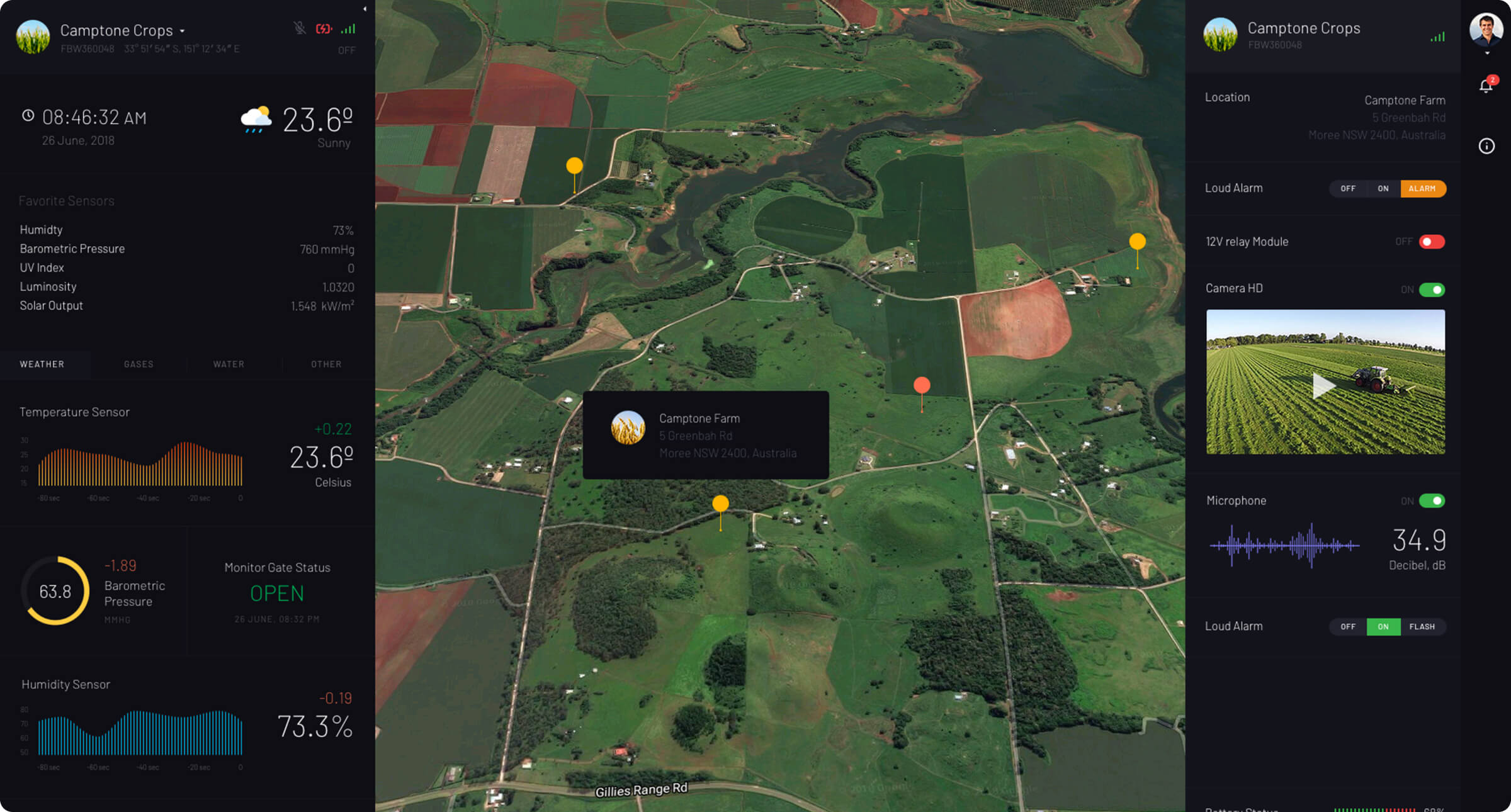
The platform provides access to current and historical field data while presenting connected devices in their geographic context. Farmers can review environmental conditions, inspect device information, monitor equipment, view imagery, and manage supported infrastructure without switching between separate systems.
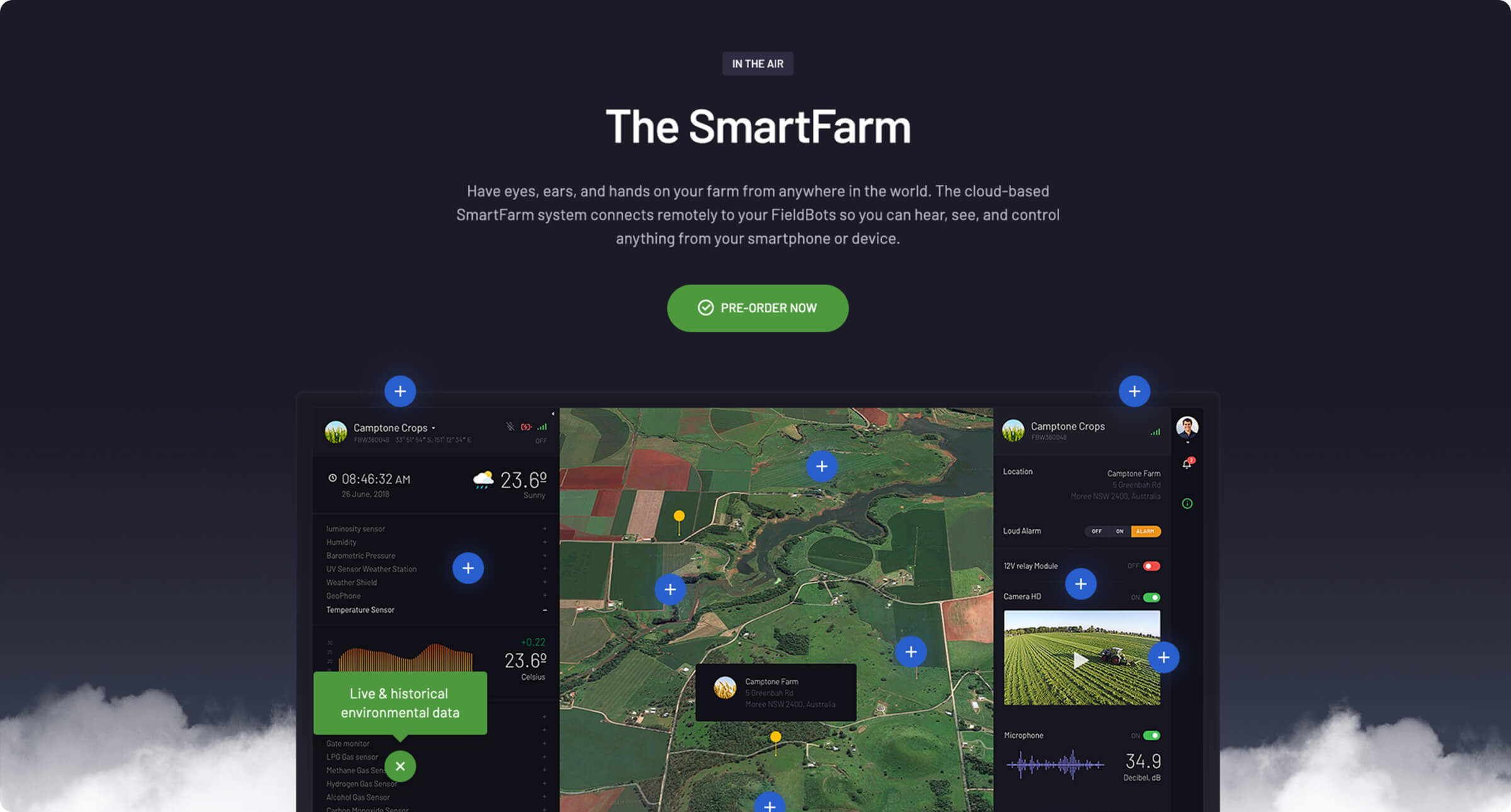
SmartFarm was designed to support multiple FieldBots and different agricultural use cases across an entire property. Its interface combines a central interactive map with contextual panels, status indicators, charts, media, and device controls. Independent industry coverage also describes SmartFarm as the cloud-based data and control layer connecting FieldBot hardware with external farm systems.
Core Challenges
SmartFarm needed to organize large amounts of heterogeneous information from sensors, connected devices, imagery, equipment, and third-party services. Users had to understand both where an event was occurring and what the underlying operational data meant.
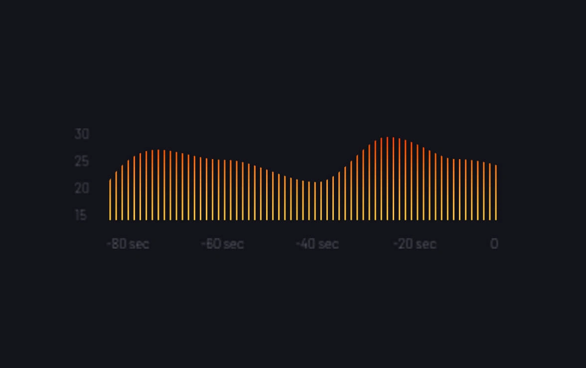
Remote farm management also requires clarity and confidence. The interface needed to distinguish live conditions from historical trends, surface important device states, and provide direct controls without allowing the map, charts, imagery, and navigation elements to compete for attention.
The Solution
A custom UI system was designed around the farm map as the primary workspace. Contextual side panels present property information, connected devices, sensor measurements, charts, images, and available controls while keeping the geographic overview continuously visible.
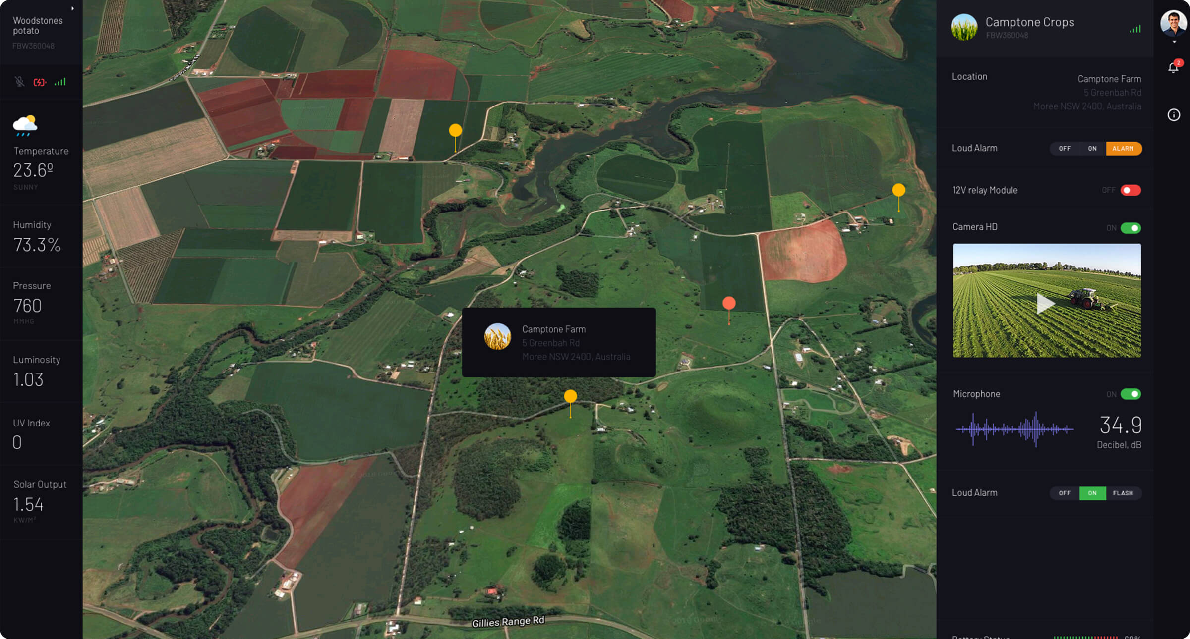
The application was developed with Laravel and React, with Google Maps supporting its spatial interface. Modular frontend components and structured APIs separate data processing from presentation, providing a scalable foundation for additional sensors, automation rules, equipment integrations, and data sources.
Key Outcomes
SmartFarm brings geographically distributed farm information into one coherent operational environment. Farmers can move from a property-wide overview to an individual device or measurement without losing its physical context.
The modular application architecture supports the continued expansion of the FieldMicro ecosystem. New FieldBots, farms, sensor types, integrations, and control capabilities can be introduced while maintaining a consistent monitoring and management workflow.